

Here is a map of the grid which shows where the temperature data was collected. The rectangle I chose was 15° West to 35° East in longitude and 10° North to 35° North in latitude. As you can see, there is a lot of the middle of the desert that is not being measured. Still, there were a total of 42,708 seasonal readings, so this is not a place with next to no data like certain regions of the poles.

Until this century, the Winter temperatures in the Sahara were bouncing around somewhat randomly, even showing a mild cooling trend when we look at the record highs and lows. The median was climbing up but only slightly.
Then came the 1999-2010 time period and things jumped up on both the record highs and record lows.
Change in 1955-1975 median to 1999-2010 median: 0.872° C, more than the worldwide average of about 0.5° C. I arbitrarily consider 1 degree Celsius to be the cut-off for very serious warming.

The Spring data was showing some warming in the last half of the 20th Century and that only increased in the first decade of the 21st.
Change in 1955-1975 median to 1999-2010 median: 1.164° C.

The Summer data shows the classic increasing temperature steps.
Change in 1955-1975 median to 1999-2010 median: 1.1185° C.

Change in 1955-1975 median to 1999-2010 median: 1.178° C.
Confidence level of the trend showing increasing warming: 97.9%
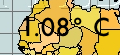
Average seasonal change in the medians of 1955-1975 to 1999-2010: 1.08° C.
Like much of the Arctic Circle and parts of Western Antarctica, the Sahara is one of those regions that show serious warming over these 56 years.
No comments:
Post a Comment